MariMap
Marine MRV and reporting for coastal ecosystems.
MariMap brings together projects, sites, and survey evidence so teams can deliver disclosure-grade monitoring across coral reefs, seagrass, and mangroves.
Designed for coral reefs, seagrass, and mangroves
MariMap standardizes marine field data, connects it to satellite context, and produces reporting outputs that support TNFD, CSRD, ESRS, and EU Taxonomy disclosure workflows without overstating claims.
Teams preparing biodiversity credits can align evidence and claims discipline with Biodiversity Credit Alliance (BCA) guidance while keeping certification decisions with accredited standards.
Use MariMap to manage baselines, repeat surveys, and long-term monitoring cycles across MPAs, restoration sites, and nearshore tenure areas. Each metric is traceable to protocol, location, and time so reviewers can verify evidence with confidence.
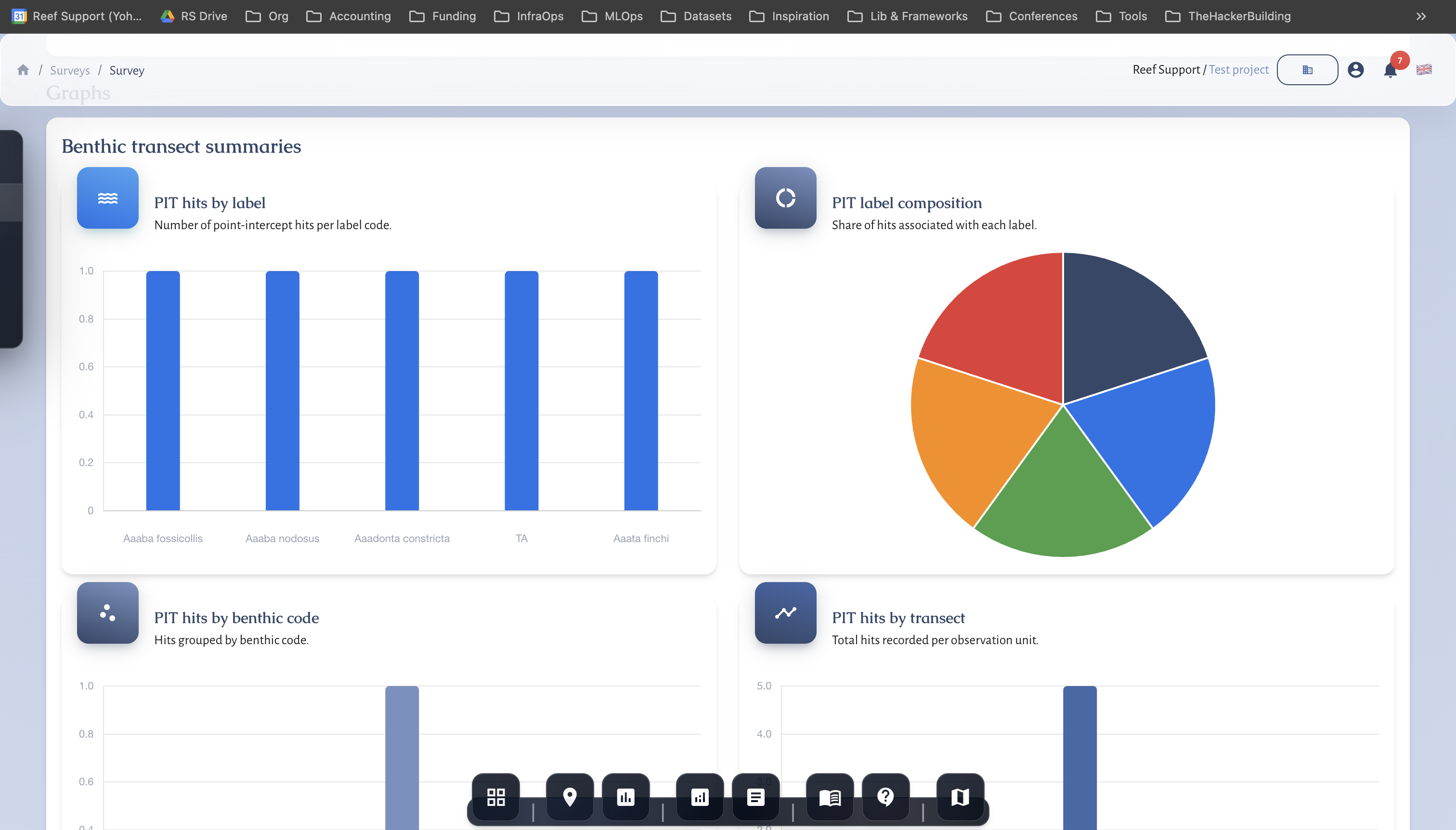
MRV workflows
Baseline and repeat survey planning with QA/QC and audit trails built for marine MRV.
Biodiversity and habitat metrics
Standardized indicators for benthic cover, fish biomass, seagrass density, and mangrove health.
Verification-ready reporting
Exports with protocol metadata, metric definitions, and evidence links for funders and verifiers.
Governance and access
Role-based permissions, review workflows, and data sharing controls for multi-partner projects.
Product tour
See MariMap in action.


Ready to explore the platform?
Book a demo to see MariMap in action.