Each year, billions of pounds of trash and other pollutants enter the ocean. Some of the debris ends up on our beaches, washed in with the waves and tides. Waste then sink, eaten by animals that mistake it for food or accumulate in ocean gyres. Despite the economic benefits of tourism, beach managers have grown increasingly resistant to continued resort development due to lack of clear predictive insights and planning strategies. We brings informative insights to better manage coastal and land-based pollution for healthier beaches and coastlines.


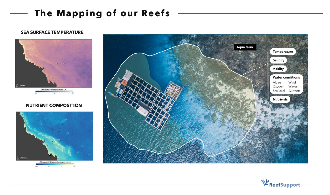
Satellite data provides us with a powerful, global perspective on the ocean–coast interface. By combining optical and radar imagery, we track changes in sea surface temperature, chlorophyll-a, turbidity, and coastal vegetation indices over time. This wide-scale monitoring enables us to detect anomalies early, prioritize restoration sites, and measure seasonal or long-term trends. As used in MariMap, satellite-derived datasets help guide decisions on mangrove outplanting by highlighting areas of coastal erosion and tidal dynamics. By integrating EO capabilities, we ensure our partners and local communities can act faster and more confidently in protecting marine ecosystems.
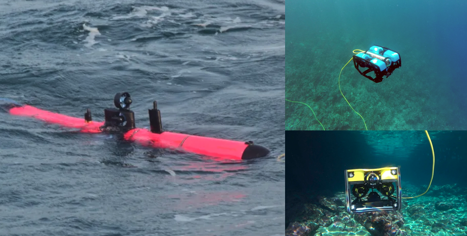
For high-resolution insights, we work closely with hardware partners deploy underwater ROVs and aerial drones to capture detailed imagery of reefs, mangroves, and seagrass beds. These technologies allow us to build 3D models of reef structures, assess coral cover, map debris hotspots, and even track invasive species like crown-of-thorns starfish. In MusselAI, we used drone and ROV imagery to validate AI models and improve habitat mapping for restoration activities.

.png)
We integrate data from different technologies (satellites, drones, sensors) and perform analyses on the historical behaviour of different phenomena in specific marine environments; coral reefs, mangroves, aquaculture, offshore. The data available via the app includes: water quality parameters like chlorophyll-a, total suspended matter and turbidity as well as sea surface temperature.
We then apply prediction models and geospatial analysis to perform risk and impact assessments. The tool has played a significant roles in the selection of optimal sites for coral restoration or harvesting times for seafood cultivation.
Together with Indonesia Biru Foundation, we set up the first land-based coral farms in the Central Indonesia Region to integrate breakthrough methods to accelerate coral growth up to 50 times (using the technique of micro-fragmentation) while enhancing their resiliency to warming and acidifying oceans (assisted evolution). In micro-fragmentation the corals will be cut into smaller polyps, which stimulates tissue growth.
.jpeg)

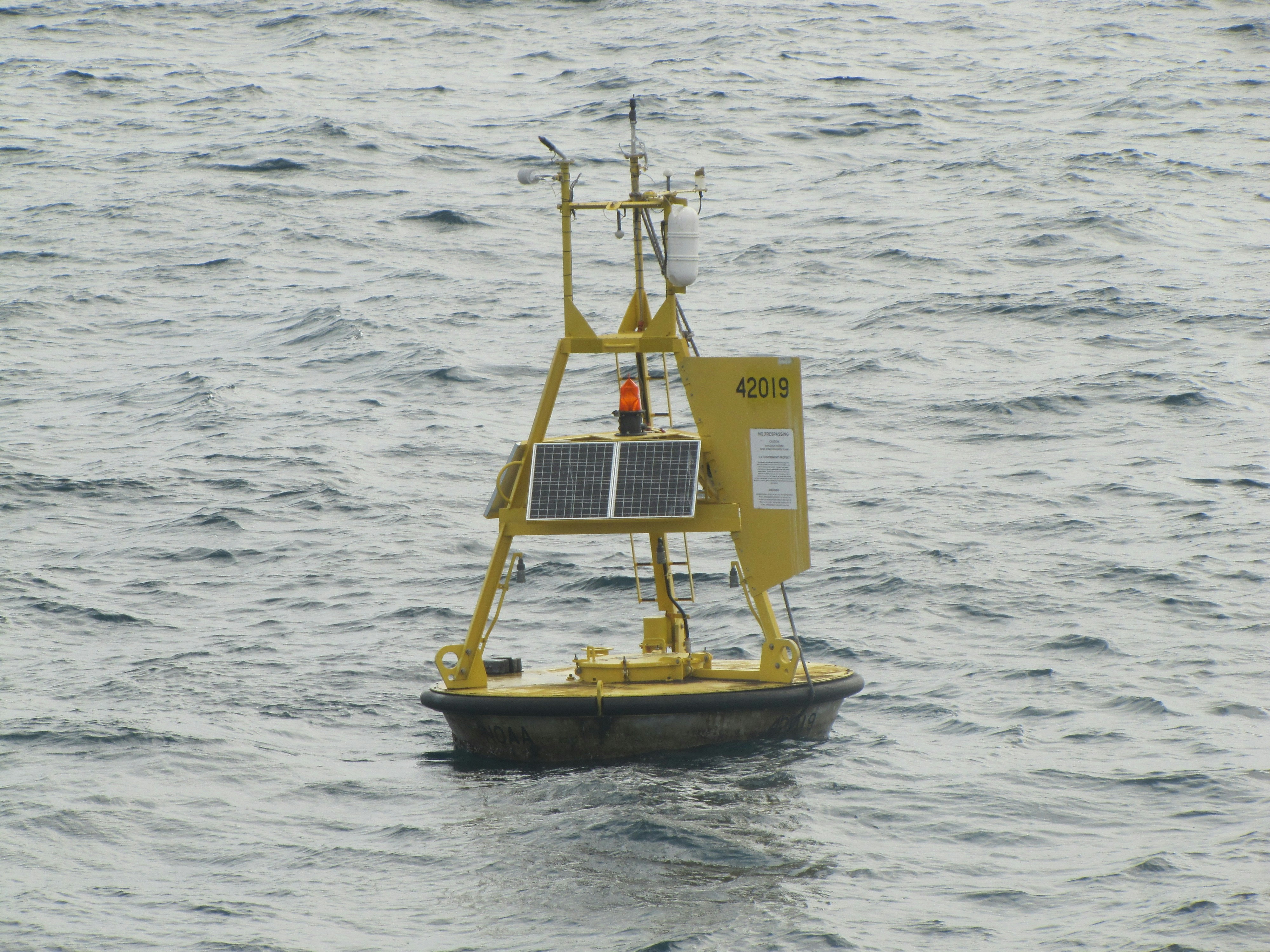
We extract information from in-situ sensors and smart buoys that record temperature, salinity, dissolved oxygen, pH, turbidity, and current dynamics in real time. These time series are essential for calibrating satellite observations and AI predictions, while also providing critical thresholds for early-warning systems. In our coastal monitoring projects, these instruments help us identify stress events such as heatwaves or sudden drops in oxygen before they cause large-scale damage. By coupling these datasets with community and satellite observations, we create a robust, multi-layered view of ecosystem health that supports restoration, policy, and long-term resilience planning.
Local communities are at the heart of sustainable ocean monitoring. Through our apps and ranger programs, citizen scientists—including divers, fishers, and volunteers—contribute valuable geo-tagged observations. These include reports on coral bleaching, species sightings, marine litter, and mangrove growth in nurseries. In Lombok, Indonesia, our citizen science initiatives have empowered local partners to track restoration progress and report early-warning signs directly from the field. This participatory approach not only expands the reach of our datasets but also fosters ownership and stewardship among the very communities that depend on healthy marine ecosystems.

Leveraging the power of satellite imagery, our cutting-edge technology trains models to detect plastic debris in both oceanic and river environments. Currently, we are conducting case studies in The Netherlands and Romania, refining our algorithms to accurately identify and track plastic waste. Do you clean up plastic waste or work in it's supply chain, join us today and contribute to a cleaner future by harnessing the potential of AI and ML in tackling plastic pollution.

At Reef Support, we believe that effective marine conservation requires more than isolated datasets—it requires integration. By combining satellite imagery, underwater ROVs and drones, citizen science, and in-situ sensor networks, we deliver a comprehensive, multi-layered understanding of marine and coastal ecosystems. This holistic approach ensures that decision-making is guided by both global insights and ground-truth realities.
Our projects across Indonesia, Colombia, and beyond demonstrate how these methods translate into impact. From guiding mangrove outplanting with satellite-derived coastal data, to validating reef health with underwater imagery, to empowering local rangers through citizen science, we create systems that scale from community stewardship to international monitoring.
Each partner we work with benefits from reliable analytics, transparent reporting, and actionable insights tailored to their needs.
We invite NGOs, research institutes, government agencies, and private partners to join us in building the future of BlueTech for conservation. By working together, we can transform data into meaningful action—protecting reefs, restoring coastlines, and strengthening communities who depend on healthy oceans.
The technology behind Reef Support is only as strong as the partner community that is building applications on it and taking practical action. If you are interested in scaling your environmental sustainability work with the power of the cloud and AI, do get in touch with our team. For students/researchers based with accredited educational institutions, we have tailored programs for you, please contact us directly with your specific research needs.