
Every tier / ladder step measures the same core facts—live-coral cover, which species are present, how many of each, and how key indicator species are doing.
What changes as you move up the tiers is how you collect those facts: the gear becomes more precise, you cover more seafloor, and results arrive faster.
Think of this as a rough guide on how current capabilities can have an impact on coral reef monitoring at every organizational level. Scroll down to see the typical gear needed for a beginner to start reef monitoring.
More more support & full manual (30 pages),
please contact us on the contact page.
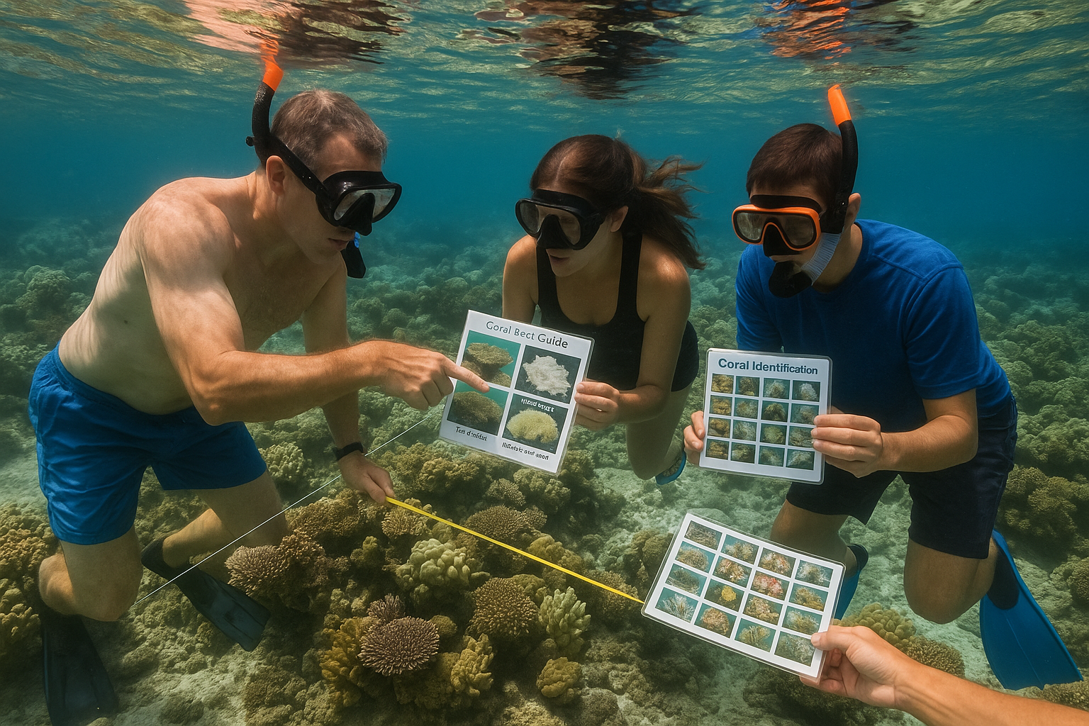
Typical users School groups, eco-tourists, brand-new community projects.
What they actually do People snorkel over the reef with a guide. Picture cards show the difference between hard coral, soft coral and a bleached patch. No numbers yet—this stage simply builds excitement and reef literacy.
Cost & skill Mask, snorkel, laminated ID cards—well under 100 USD. A half-day talk is enough.
When to consider Tier 1 As soon as the group wants real numbers that can be tracked year to year.
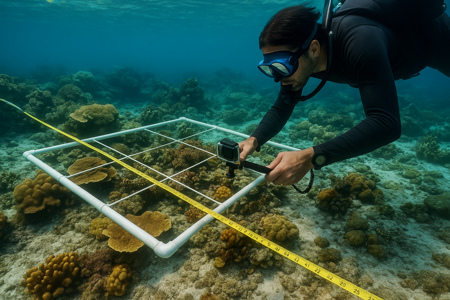
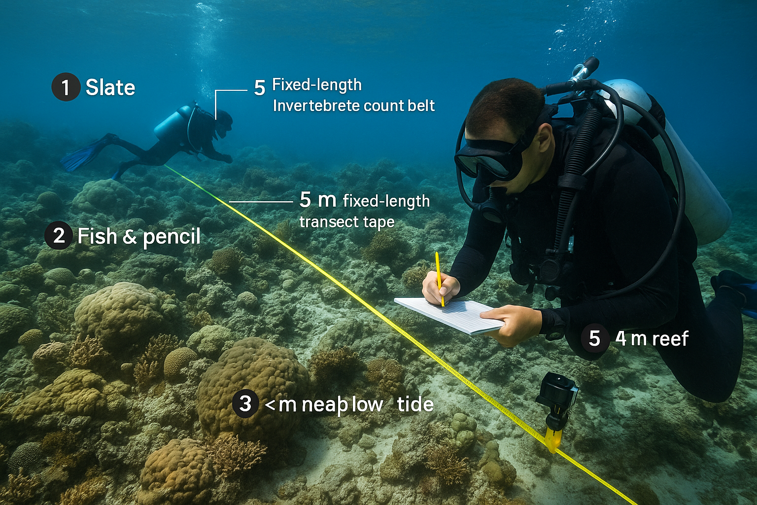
Typical users Local NGOs, dive clubs, small marine-reserve staff, Reef Check-style citizen-science teams.
What they do
Cost & skill Startup gear runs 200–500 USD (tapes, slates, GPS, action cam). A two-to-three-day field course turns confident snorkellers or divers into reliable surveyors.
Strength Inexpensive; unbeatable for community engagement.
Limitation Accuracy depends on observer skill, and the small area sampled can miss patchy problems.
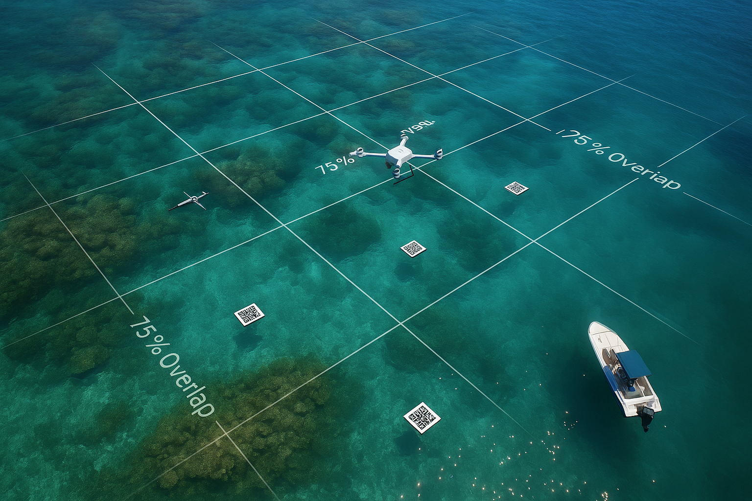
Tier 2 – Semi-autonomous photo-transects
Typical users Regional environment offices, university field classes, citizen-science projects that have already logged Tier 1 data.
What they do
Cost & skill $ 200 - 1000 buys a good action camera with proper lighting (attachments), tray or tow-sled and a basic drone. Each survey run costs roughly $1000 (fuel, cloud time). One week of training covers photo-mosaics and Coral-AI use.
Strength You may map ten to twenty times the area per day, and the photo archive is a permanent audit trail.
Limitation Needs a laptop, steady electricity and basic internet to push imagery to the cloud.
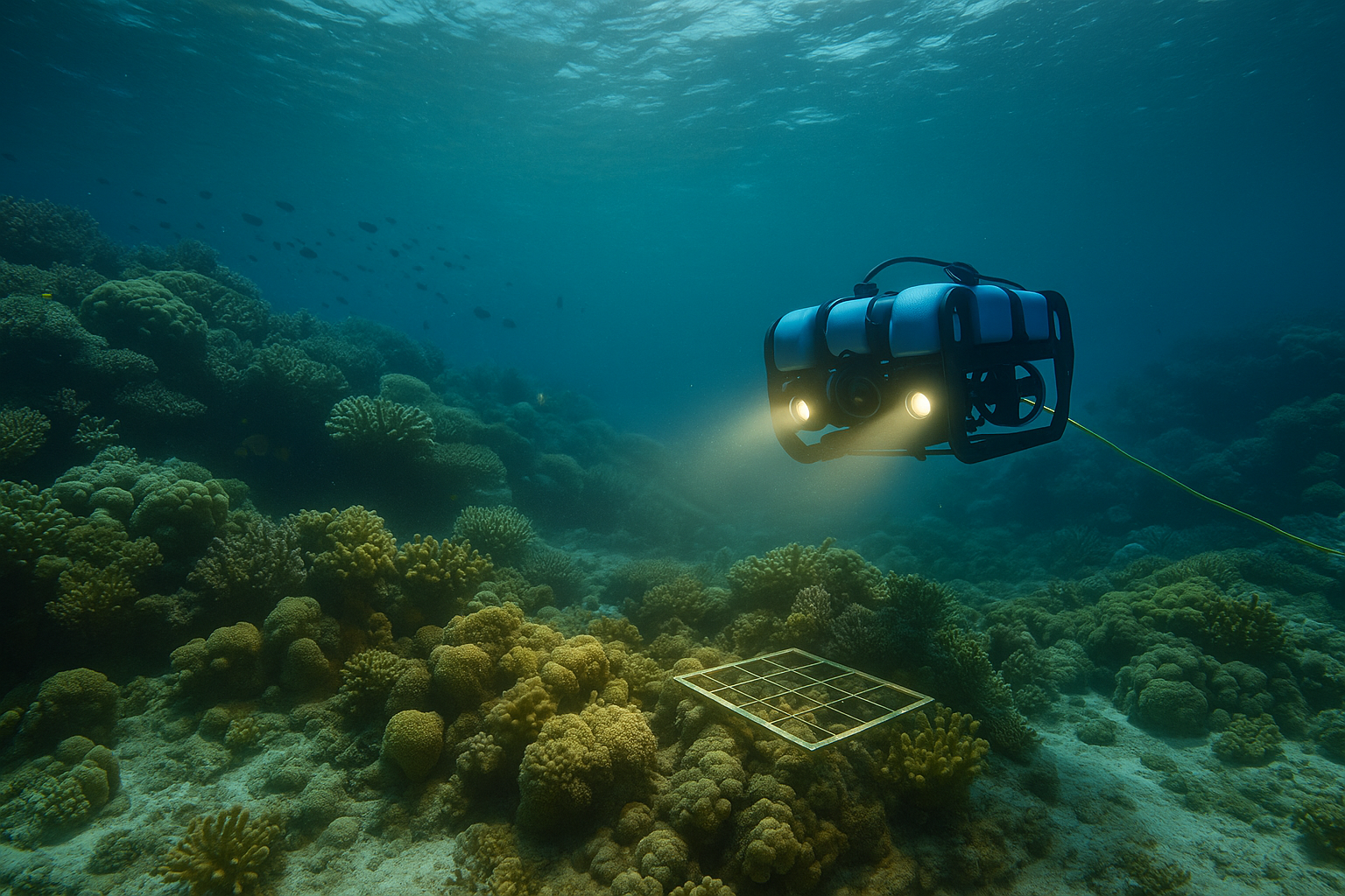
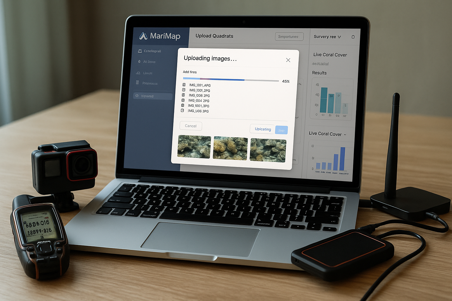
Typical users National park services, blue-carbon verification projects, offshore industries with strong compliance budgets.
What they do
Cost & skill Hardware (especially a good camera, ROV set up) begins around $3 - 5000; a typical mission costs $400–800. Two weeks of vendor training turn staff into competent pilots and maintainers. An option is also to rent a local ROV near you, or through one of our partners in Europe.
Strength Unmatched coverage, repeatability and speed—sufficient for carbon-credit audits or courtroom-quality evidence.
Limitation High capital cost, import permits and the need for skilled technicians.
Whenever two or more gaps start to bite, it saves money in the long run to invest in the next tier.
No matter which tier you operate in, you will always record:
What improves as you climb the tiers is accuracy, area, and speed, not the fundamental questions.
Start where your budget lets you; structure your data so it flows into MariMap; and move up a tier whenever precision, coverage or response time becomes critical.
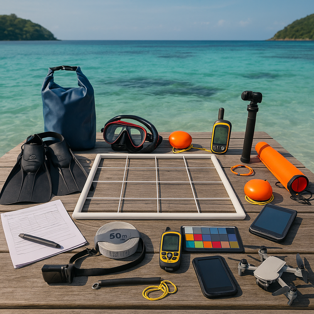
① Fiberglass tape (50 m)Lays the fixed-length transect for point-intercept and photo passes.
② PVC quadrat (1 × 1 m)Spot-checks habitat complexity; reference scale for Coral-AI image tiles.
③ Slate + golf pencilManual point-intercept tally every 0 .5 m; backup if camera fails.
④ Mask, snorkel, finsMinimum snorkel kit—Tier 1 teams need no SCUBA.
⑤ Action camera on gripCaptures stills/video every 0 .5 m for Coral-AI processing.
⑥ Hand-held GPS & spareLogs start/stop of each transect; embeds EXIF geopoint in images.
⑦ Twin orange SMB buoysMark transect ends; serve as surface-safety reference.
⑧ Deploy-line & reelKeeps SMB vertical; doubles as emergency buddy line.
⑨ Colour-cal card (24-patch)Ensures Coral-AI colour correction, compensating for depth/lighting.
⑩ Waterproof phone & drybagRuns Marimap Capture app; previews images, pushes metadata offline.
⑪ Compact drone (Tier 1.3 add-on)Orthomosaic of the site; maps coral rubble fields and entry/exit.
⑫ Spare batteries & SD cards (in Pelican case)Enough capacity for full belt of imagery plus redundancy.

